
미리 보기 크기: 800 × 400 픽셀 다른 해상도: 320 × 160 픽셀 | 640 × 320 픽셀 | 1,100 × 550 픽셀
원본 파일 (1,100 × 550 픽셀, 파일 크기: 20 KB, MIME 종류: image/png)

|
이 그림은 벡터 그래픽 버전(SVG)이 있습니다. 래스터(비트맵) 그림 대신 벡터 그래픽 그림을 사용하는 것이 좋습니다.
File:Limited recognition.png → File:Limited Recognition States.svg
|
 |
| English | |
|---|---|
| No recognition by any state | |
| Recognized by UN non-members only | |
| UN non-members recognized by at least one UN member | |
| UN member states, not recognized by at least one other state | |
| UN member states, recognized by all other states | |
| 설명 |
Nederlands: Lijst van niet of gedeeltelijk erkende staten
中文(简体):未被普遍承认的国家地图
中文(繁體):未被普遍承認的國家地圖
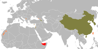
This is a map of states that meet the inclusion criteria at en:List_of_states_with_limited_recognition#Criteria_for_inclusion. Importantly, only states which "satisfy the en:declarative theory of statehood" or which are "recognised as a state by at least one en:UN member state" are included. |
| 날짜 | (UTC) |
| 출처 | |
| 저자 |
|
| 다른 버전 |
 |
| 이 그림은 수정된 그림으로, 원래 그림에서 디지털 변환이 이루어진 그림입니다. 수정 사항 : regroup the states per en:List of states with limited ecognition. 원래의 그림 : Recognition problems Barry Kent.png:
|
| This map is ineligible for copyright and therefore in the public domain, because it consists entirely of information that is common property and contains no original authorship. For more information, see Commons:Threshold of originality § Maps.
|
기존 올리기 기록
This image is a derivative work of the following images:
- File:Recognition_problems_Barry_Kent.png licensed with Cc-by-2.5, Cc-by-sa-3.0-migrated, GFDL
- 2010-02-03T14:04:22Z EmilJ 1248x661 (33.636 Bytes) fix collateral damage
- 2010-02-03T11:33:38Z EmilJ 1248x661 (33.668 Bytes) adjust Somaliland/Puntland boundary
- 2009-12-29T14:46:47Z EmilJ 1248x661 (37.111 Bytes) Liechtenstein and Slovakia normalized relations
- 2009-12-08T17:48:16Z EmilJ 1248x661 (33.669 Bytes) fix colour of Cyprus
- 2009-09-07T11:47:13Z EmilJ 1248x661 (33.704 Bytes) add Armenia, per [[:en:List of states with limited recognition]]
- 2009-07-13T14:42:14Z EmilJ 1248x661 (33.690 Bytes) Liechtenstein recognized the Czech Rep.
- 2009-07-08T13:56:41Z EmilJ 1248x661 (33.739 Bytes) correct the position of Liechtenstein, enlarge it to make it visible
- 2008-08-26T12:41:24Z Soman 1248x661 (57.342 Bytes) change abkhazia and s ossetia to pink, as Russia has now recognized those states. Change Kosovo border to same style as other pink areas.
- 2008-08-10T17:18:13Z IJA 1248x661 (57.422 Bytes) added North Korea, South Korea, Czech Republic, Slovak Republic and Liechtenstein
- 2008-04-15T18:29:14Z Barry Kent 1248x661 (57.299 Bytes) {| align=center width="800px" style="width:800px; vertical-align:top; border:1px solid #abd5f5; background-color:#f1f5fc;" ![[English]] |- | {{legend|#FF0000|No international recognition}} {{legend|#FF8484|Limited recognitio
- 2008-04-13T10:11:39Z Happenstance 1248x661 (33.754 Bytes) +liechtenstein (not rec by CR, Slovakia)
- 2008-03-19T19:22:04Z Barry Kent 1248x661 (57.292 Bytes) {| align=center width="800px" style="width:800px; vertical-align:top; border:1px solid #abd5f5; background-color:#f1f5fc;" ![[English]] |- | {{legend|#FF0000|No international recognition}} {{legend|#FF8484|Limited recognitio
Uploaded with derivativeFX
파일 역사
날짜/시간 링크를 클릭하면 해당 시간의 파일을 볼 수 있습니다.
| 날짜/시간 | 섬네일 | 크기 | 사용자 | 설명 | |
|---|---|---|---|---|---|
| 현재 | 2024년 1월 7일 (일) 06:32 | | 1,100 × 550 (20 KB) | wikimediacommons>Iktsokh | Azerbaijan has regained de facto control over its internationally recognized territory (Republic of Artsakh completely ceases to exist from January 1, 2024). |
이 파일을 사용하는 문서
다음 문서 1개가 이 파일을 사용하고 있습니다: